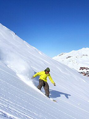
© Cameron | Instagram
Snow Report 13th April 2023
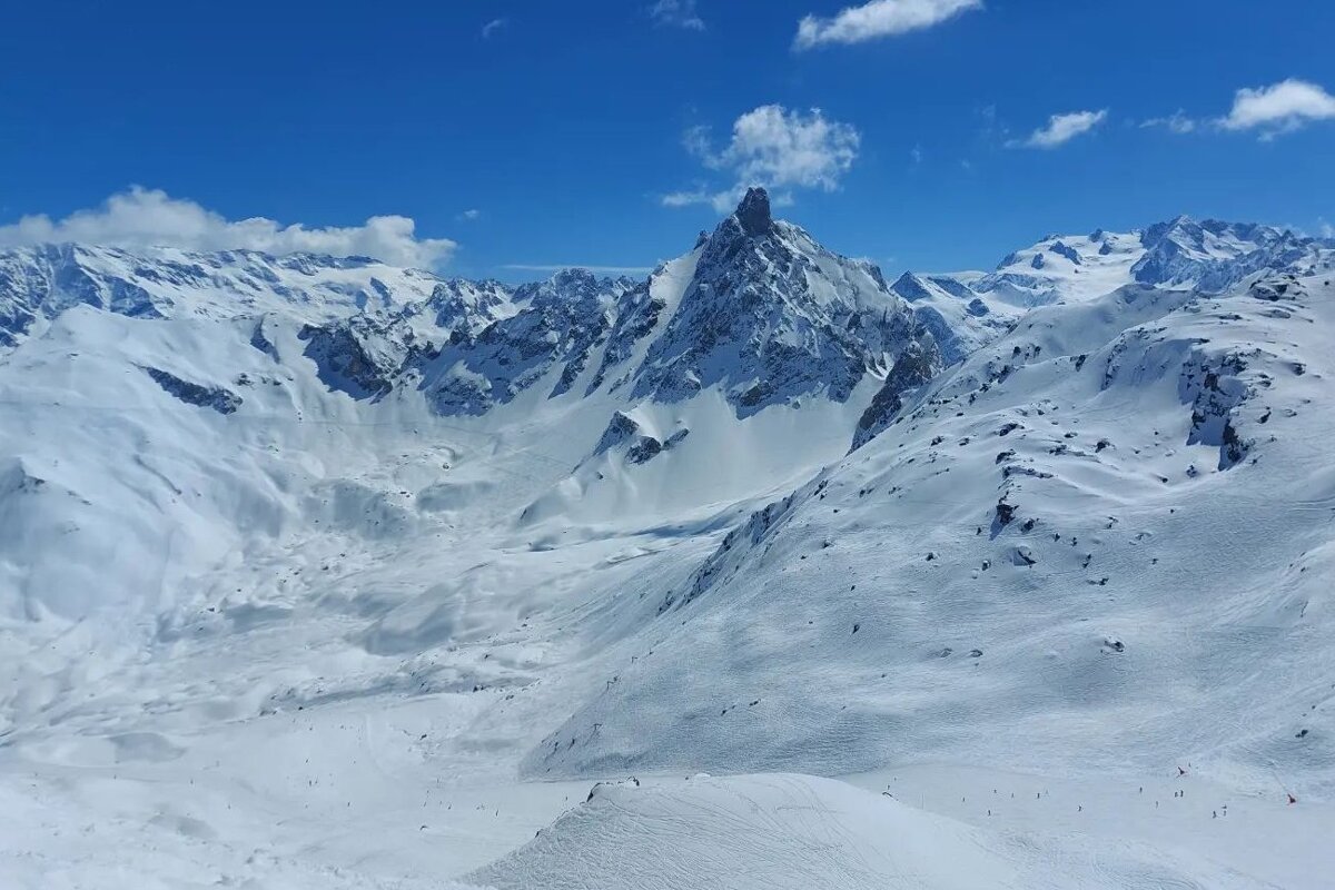
We did enjoy a good sunny Easter weekend in Val Thorens following a light to moderate snowfall on Friday as predicted. The last few days have brought a mix of rain and snow according to altitude and Wednesday night we got a good snowfall of around 14cms over about 1550 metres. It’s snowing a little today too. The cold weather remained with us meaning that the snow has stayed in good condition. Typical spring skiing conditions prevail, a little icy and firm in the mornings, softening up through the day and a bit slushy after lunch.
And so the snow continues to fall! This is due to a cold front from the northwest. We can expect 20 - 30cms over about 1800 - 2000 metres in the next couple of days in Val Thorens. However the snowline will drop to around 1200 - 1500 metres in the next day or so. Friday looks like some sunshine, so that will be the day to enjoy the new snow and fresh powder. The weather from the weekend onwards looks unsettled with light snow forecast and unseasonably cold temperatures and a freezing level of around 1400 - 1800 metres.
The avalanche risk is showing as considerable, so heed the warnings in resort. It is mid-April now and with new snow on top of a weak base layer and warming temperatures, conditions off-piste would be far from ideal.
Great shot above from Cameron out in Val Thorens
Watch this
Top tips for skiing this week
- The temperature is changeable in the mountains. We’re technically spring skiing, although it still feels cold, it’s definitely chilly out of the sun and there is not much sun forecast for the next few days. So a mixture of thickness layers, a shell jacket rather than a thick winter coat, more lightweight gloves are a good idea, and open those vents when the day warms up! You may need a waterproof jacket Saturday, Sunday and Monday though.
- Don't forget the sunscreen! Even when the windchill is high, the sun in the mountains is still intense.
- You’ll need your goggle lenses for sun and flat light this week
- Early morning the pistes are harder packed and maybe a bit icy and then a bit slushy in the afternoon. So coordinate your ski time to whichever conditions you prefer.
- Get your skis and boards waxed as the wetter snow can slow you down a bit!
- Check the forecast and choose the right day to book the sunny restaurant terrace for lunch
Updates
If you head down this page, you can see live forecasts, lift status, links to webcams from Val Thorens. We will be updating this snow report page every Thursday, so check back in with us to see how the pistes are doing and what you can expect from the snow forecast each week.
We need you!
If you're in Val Thorens this week, we want to see your images, especially videos, of what you've been up to. So when you post to Facebook or Instagram, please tag us @SeeValThorens #seevalthorens. Every week, we'll be posting our favourite videos and images here and sharing on our social media, along with our weekly resort snow report.
Enjoy the skiing, we’ll see you out on the pistes.
![[itemref] living-room](https://cdm0lfbn.cloudimg.io/v7/_images_base_/image_uploader/arkiane/original/inter_00210069.jpg?ua=1579868382&p=carousel)