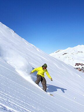
© dr_francesco_enia | Instagram

Snow report, 27 March 2025
Another week of changeable weather here and cooler temperatures with sunshine, cloud, a little rain and snow!. Those pisteurs have been maintaining and grooming the slopes fabulously to give us great ski conditions daily.
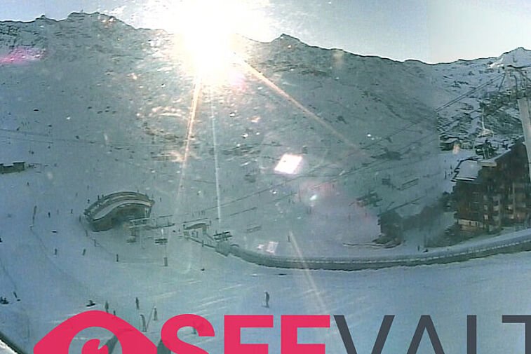
Current weather in Val Thorens
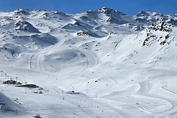
The lower slopes are holding up well, with most still open, although some connecting runs are starting to suffer. Higher up the snow remains plentiful and in good condition.
We’ve got typical spring conditions, tending to be icy in the early mornings, reat skiing mid-morning and then softening into slush from around 14:00. Daytime temperatures at 2300m are between 0°C and -2°C.
Fresh snow incoming…
A change in temperatures is on the way, bringing fresh snow on Friday night into Saturday. We could see up to 5cm, with the freezing level dropping to around 1200m on Saturday night. This sets Sunday up to be a good powder day, with some sunshine expected, though it will stay chilly with light breezes.
From Sunday into early next week, temperatures will rise a little, reaching around 2°C on Tuesday at 2300m, and the snow line will climb to roughly 2000m. Light snow showers are predicted for Monday afternoon. Expect freeze-thaw conditions—icy slopes in the morning, gradually softening through the day.
Avalanche risk
The avalanche risk is currently 2 out of 5 (moderate). Wind slabs represent the main danger and where there are weak layers in the old snowpack which can be triggered by skiers. Moist and wet avalanches require caution. The most prone locations are likely to be found around the base of rock walls and where there are abrupt changes in terrain and in gullies and bowls, however these are difficult to recognise.
As always, exercise extreme caution. If heading off-piste, ensure you have the proper equipment, up-to-date weather information, and seek advice from the resort or a qualified guide.
Watch this
Top tips if you are skiing this week
We have quieter pistes and spring-like ski conditions. There are plenty of events planned in Val Thorens in the next few weeks, check out our events calendar.
- The temperature is changeable in the mountains and this weeks weather is a mixed bag, but a little warmer than last week. So layers, a shell jacket, sunglasses or goggles with the low light and sunshine lens this week, more lightweight gloves are a good idea, but you may need something waterproof on Saturday!
- Get out on the slopes early and plan a late lunch to make the most of the spring-like snow, before it gets slushy
- Book your table for lunch on an outdoor terrace, in advance to avoid disappointment. Looks like good sunny weather on Monday and Tuesday next week
- Don't forget the sunscreen! the sun in the mountains is intense.
- The pistes can be quite hard-packed in places, but the snow on the sides of the runs is often softer. Keep to the sides of the pistes for a more effortless, less icy experience.
There is still time to book for a last minute ski escape - check out where to stay in Val Thorens.
Updates and be social
Scroll down to see live forecasts, lift status, links to webcams and above for real time photos from Val Thorens. We will be updating this snow report page every Thursday, so check back in with us next week to see how the pistes are doing and what you can expect from the snow forecast for the next seven days.
We need you!
If you're in Val Thorens this week, we'd love to see your images, especially videos, of what you've been up to. So when you post to Facebook or Instagram, please tag us @SeeValThorens #seevalthorens. Every week, we'll be posting our favourite videos and images here and sharing on our social media, along with our weekly resort snow report.
See you out there on the slopes, and don't forget to tag us in your adventures!
![[itemref] living-room](https://cdm0lfbn.cloudimg.io/v7/_images_base_/image_uploader/arkiane/original/inter_00210069.jpg?ua=1579868382&p=carousel)